Choose a Douro viewpoint by what it overlooks and how you will reach it: Casal de Loivos and São Leonardo da Galafura belong to different local plans. This page owns the named scenic stops, access questions and combinations with a nearby base. It does not repeat the region-wide things-to-do list or replace the map’s orientation. A viewpoint pin is not proof of an easy walk from the river.
On this page · 6 sections
Match the viewpoint to the day
The named locations below are recognised in the national tourism guide. The access implications and itinerary fits are editorial planning advice rather than claims that a particular tour stops there. VisitPortugal: The Douro Valley.
| Viewpoint | Best paired with | Why it adds something different |
|---|---|---|
| Casal de Loivos | Pinhão and its surrounding wine landscape | A higher perspective on the town and river bend |
| São Leonardo de Galafura | A Régua-area road itinerary | A broad landscape view beyond the riverfront |
| São Salvador do Mundo | São João da Pesqueira and a further-inland plan | A distinct gorge-and-hillside context |
The table is not a ranking of beauty. The useful winner is the one that contributes to your day without turning a short scenic stop into a disproportionate transfer.
Casal de Loivos: place the town in its landscape
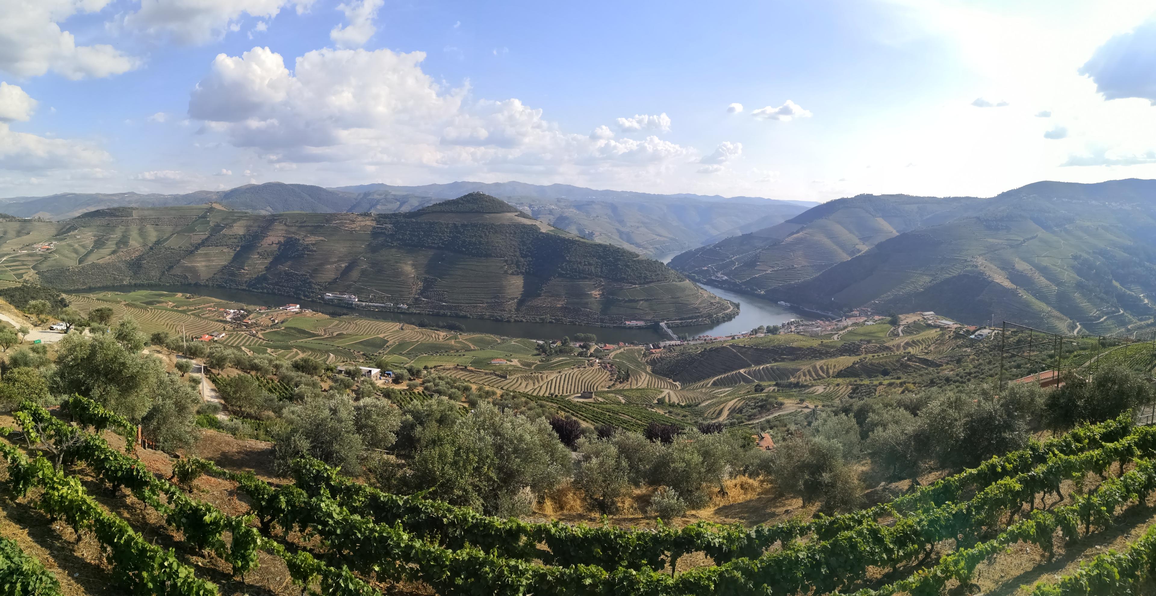
Casal de Loivos is valuable because it changes your understanding of Pinhão. At river level you see a narrow part of the landscape; from above, the settlement, bends and vineyard slopes become a larger composition. It pairs particularly well with time on the water because the two perspectives explain one another.
Give it a defined place in the itinerary. If travelling independently, arrange how you get up and back before leaving the town. If walking is the goal, research the actual route, terrain, weather and daylight as a walk in its own right. A line between the station and a lookout on a screen is not enough preparation. The Pinhão guide helps you decide what to omit to make room.
São Leonardo de Galafura: a named landscape above Régua
São Leonardo de Galafura sits east of Galafura village at 566 metres, in the municipality of Peso da Régua. The regional tourism authority also identifies its connection with the writer Miguel Torga, marked by an inscribed stone. These details make it a cultural landscape stop as well as a river photograph. Official regional viewpoint description.
Pair it with Régua when you have road transport: the museum supplies the wine-region story, while the elevated view lets you read that story across the slopes. Looking for the river, cultivated hillsides and settlements is more rewarding than simply collecting a panorama and leaving. This pairing does not imply a walking extension from the station.
For a car-free town day, keep the museum and riverfront as the complete plan unless the outward and return road transfer is arranged. The source confirms the place and its altitude, not a barrier-free route, available parking space or guaranteed view in poor weather.
São Salvador do Mundo: resist treating it as nearby
The appeal of a further-inland viewpoint does not make it an effortless addition to a Pinhão day. It belongs to a different route decision, especially if your plan also includes a town, a boat and a fixed estate appointment. Use a map with actual road routing when judging whether it fits.
This is a good example of why “the Douro” should not be treated as a compact attraction. A two-day itinerary can give separate areas their own attention. A one-day programme should select rather than accumulate. The wine-region explainer helps frame that broader geography.
Look at the work, not only the water
A useful landscape stop can reveal how the land is organised: rows follow a slope, tracks connect blocks of cultivation and buildings sit inside the working estate. Compare these elements instead of looking only for the widest river panorama. The UNESCO Alto Douro inscription recognises a cultural landscape shaped by wine growing; that context gives a viewpoint more purpose than simply finding the largest bend. This makes the view worthwhile even when the light differs from the photograph you expected.
For photography, allow time to put the camera down. Stay in permitted public areas, avoid blocking narrow approaches and do not enter vineyard land just to improve the angle. A commercial estate terrace is not automatically a public viewpoint; a visitor activity or permission may be required.
A practical viewpoint brief
Choose the place, the route, the return and the reason it earns its time. Then consider conditions: heat or rain can change how enjoyable an exposed stop feels, and winter daylight can shorten the scenic window. Bring water and footwear suited to the actual plan, and use the party’s access needs to determine the approach.
For a first day, our suggested choice is one town anchor, one main activity and one optional viewpoint, with the viewpoint the first thing to omit if connections become awkward. That preserves the experience rather than sacrificing lunch or the return journey for a final photograph. Use the itinerary planner to make that trade-off visible.
Sources for this guide
Linked at the relevant claims above, and collected here for further reading. Primary-source context accessed 9 November 2026. Indicative routes and comparison verdicts are our editorial analysis; fictional tool data remains separate.
- VisitPortugal: The Douro Valley visitportugal.com
- Official regional viewpoint description discoverdouro.pt
- UNESCO Alto Douro inscription whc.unesco.org